Delhi weather today
A sudden severe weather phenomenon swept Delhi-NCR on April 5, 2021. Rain/hail and thunderstorms rolled in across entire India bringing a complete change to what started as a warm partially cloudy day into a short-lived thunderstorm-filled evening with no notice to many of the residents.
The Indian Meteorological Department (IMD) had been issuing warnings for such sudden weather changes due to an active western disturbance moving through North India.
The gradual cooling of daily temperatures as clouds began to gather was due to the cold associated with the formation of clouds to the west. The cold front, before reaching the warm air over the plains, started to develop.
Western Disturbances are responsible for these sudden changes in weather patterns within India by creating a system that transports moisture over long distances. Western disturbances are weather systems that originate in the Mediterranean and carry moist air into North India, where they have provided abundant rainfall and severe thunderstorms. When these two air masses come together, the warm air creates a lifting force, which results in the rapid development of tall cloud towers suitable for short violent but intense rain, thunderstorms, and hail.
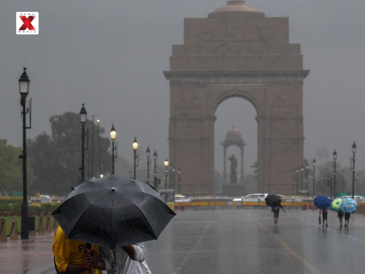
In the evening hours of March 23, gusts measuring 60-70 km/hr were encountered in many locations across Delhi-NCR resulting in several periods of rain during the evening and in some locations hail was experienced, all of these occurrences demonstrated significant intensity.
Forecasters had optimistically suggested that wind speeds of around 60-70 km/hr, while creating damage to weakly structured buildings will have the potential to disrupt movement in daily living.
In addition to all of the above-detailed storm severity impacts, decreased visibility was also created due to the sudden development of weather activity causing disruption to traffic on the roadways.
IMD has issued advisories for significant unstable weather; therefore, due to unstable weather conditions, it is recommended that individuals follow necessary travel rules (avoid unnecessary travel during thunderstorms), and remain indoors when experiencing lightning strikes.
Weather forecasters predict the current thunderstorm activity is to continue. This means more locations can expect to receive additional amounts of rain over the next several days as multiple west coast storms, also affecting Delhi-NCR area.
Due to precipitation, the daytime max temperature in Delhi NCR should be lower than today’s values, i.e., max daytime high = ~ 30-32 degrees Celsius compared to typical max daytime high early April (mid 40s). Additionally, due to cloud cover that provides cooling effect to daytime atmosphere, a further chance of unstable weather conditions continues beyond March.
There will be temporary relief from the high temperatures that are ongoing across the whole of India; however, this will still mean unstable weather conditions continue. This will also include sudden downpours, thunderstorms, high winds, and possibly severe thunderstorms, especially in the evening hours.
The effects of the current weather instability are not just confined to the Delhi-NCR region but will also have a significant impact on other regions of North India, including most of Uttar Pradesh, as well as all of Rajasthan, Madhya Pradesh, etc.
According to the IMD, there may be rain, lightning, and hailstorms over a large portion of India from 6 April 2020 through 8 April 2020. There is a high likelihood that cities such as Lucknow, Jaipur, and Bhopal will receive extremely strong winds and a tremendous amount of rainfall which could seriously affect their day-to-day activities and damage any crops that are still in season in their respective states.
Khalid Qasid is a media enthusiast with a strong interest in documentary filmmaking. He holds a Master’s degree in Convergent Journalism from AJK MCRC. He has also written extensively on esports at Sportsdunia. Currently, he covers world and general news at NewsX Digital.
Devdutt Padikkal climbed to fourth in the IPL 2026 Orange Cap race after his fifty…
Relentless rains and flash floods have killed over 120 people across Khyber Pakhtunkhwa and Afghanistan,…
IPL 2026 Purple Cap race intensifies as Ravi Bishnoi leads with five wickets, joined by…