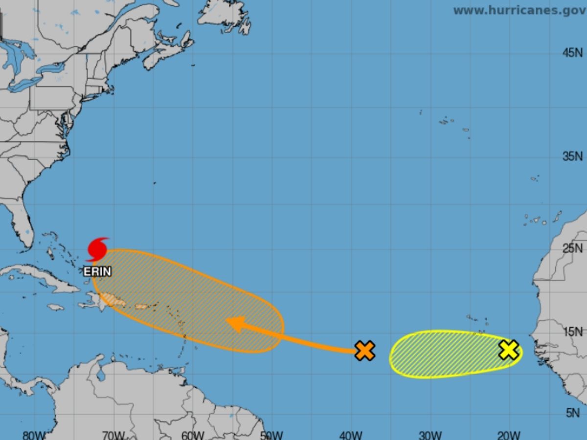
Hurricane Erin, which was moving as a powerful Category 3 storm early Tuesday, is not expected to make landfall but is already sending life-threatening waves and rip currents to the US East Coast, according to a report published by CNN. Meanwhile, a new tropical system in its wake could become the next named storm of the season.
Coastal Trouble Without Landfall
Though Erin largely remained offshore, its ultimate impact was widespread. Local media reports suggest the storm is generating destructive waves and dangerous rip currents all along the East Coast, particularly in North Carolina’s Outer Banks.
Officials in New Hanover County told the American media network Monday that at least 75 people had to be rescued from rip currents on the southern coast. Meanwhile, Wrightsville Beach has issued a no-swim advisory through Friday.
Hurricane #Erin Advisory 32: Erin Forecast to Substantially Grow in Size While Moving Over The Western Atlantic Through the Week. Dangerous Rip Currents Expected Along U. S. East Coast Beaches. https://t.co/tW4KeGdBFb
— National Hurricane Center (@NHC_Atlantic) August 19, 2025
Tropical storm watches — stretching from central North Carolina past Kitty Hawk, including Pamlico Sound — were in place. Meanwhile, Dare and Hyde counties — home to much of the Outer Banks — have issued local states of emergency, with mandatory evacuation orders issued for Hatteras and Ocracoke islands, the report said.
According to the US National Weather Service (NWS), waves could top 20 feet this week, threatening to overwhelm protective dunes and cause severe flooding.
Cape Hatteras National Seashore Superintendent Dave Hallac told WRAL that at least two homes in Rodanthe are “very, very vulnerable” to collapse due to surf-related erosion.
Bermuda and the Caribbean Feel the Outer Bands
Erin’s wide reach has already affected Puerto Rico, the Turks and Caicos, and parts of the Bahamas with flooding and power outages reported in sevral areas even as travellers and commuters faced widespread disruptions. Bermuda is also expected to witness rough seas and possibly tropical storm–force winds later this week.
Another Storm Could Be Coming
Meanwwhile, the National Hurricane Center is also tracking a tropical wave with a 60% chance of developing into a depression or named storm, according to CNN. If it strengthens, it will be named Fernand.
A third system off the African coast is also being monitored.
Erin’s Rare Intensification
Erin made headlines over the weekend when it exploded from a tropical storm to a Category 5 hurricane, reaching peak winds of 160 miles per hour, which in turn was fuelled by exceptionally warm ocean waters.


