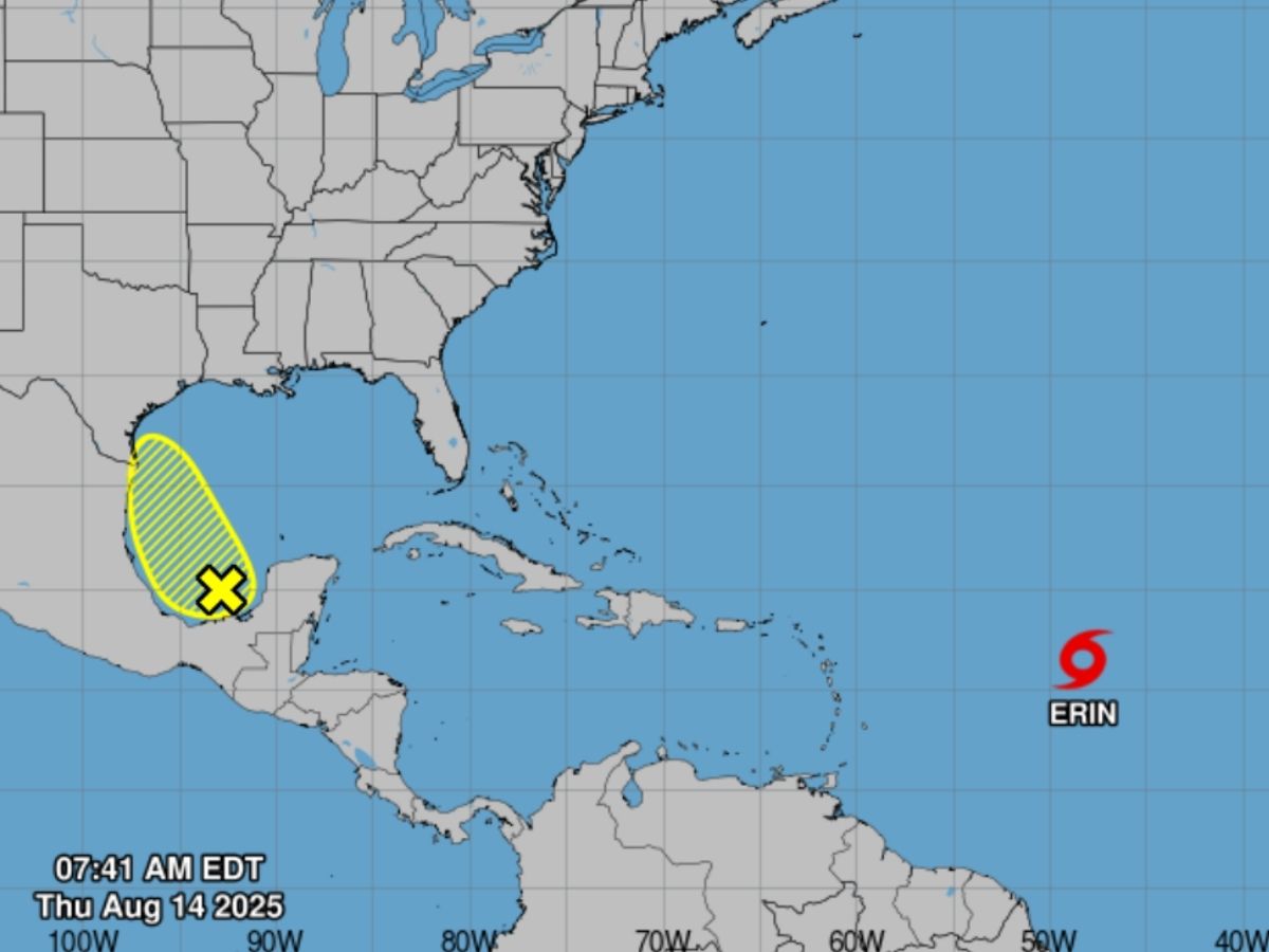
Tropical Storm Erin is heading toward the northern Caribbean, prompting warnings of heavy rain, dangerous surf, and potential tropical-storm-force winds this weekend, The Associated Press reported on Thursday. According to the National Hurricane Center (NHC), Erin is forecast to remain over open waters but pass north-northeast of islands including Puerto Rico, Antigua and Barbuda, and the US and British Virgin Islands.
Storm Erin had maximum sustained winds of around 50 mph and was moving west at 17 mph as of Thursday, but forecasters said it is expected to intensify further over the next 48 hours.
Erin Expected to Beecome A Hurricane by Friday
“Erin is moving into an area of the Atlantic primed for rapid intensification. The waters are incredibly warm,” Alex DaSilva, lead hurricane expert for AccuWeather, told AP. The NHC also warned that Erin is expected to become a hurricane by Friday, and a Category 3 storm by Sunday, with sustained winds potentially reaching 125 mph by Monday, just few units shy of being categorised as a Category 4 storm.
5am AST Aug 14: Locally heavy rainfall, high surf and rip currents, and tropical-storm force winds could occur in portions of the northern Leeward Islands, the Virgin Islands, and Puerto Rico this weekend as the core of #Erin passes north of those islands. Interests in these… pic.twitter.com/eJZ0kWseWP
— National Hurricane Center (@NHC_Atlantic) August 14, 2025
Weather experts say that the conditions Erin appears to be entering — warm sea surface temperatures and low wind shear — are classic fuel for rapid strengthening of the storm, a phenomenon where winds increase by at least 35 mph in 24 hours.
Caribbean Islands Brace for Impacts
While Erin’s center is likely to stay north of the islands, forecasters have still predicted heavy rainfall, intense waves and tropical-storm-force winds for parts of the northern Leeward Islands, Puerto Rico and the Virgin Islands for this weekend.
“There is still a greater than normal uncertainty about what impacts Erin may bring to portions of the Bahamas, the east coast of the United States, and Bermuda in the long range,” the National Hurricane Center said in its latest advisory, according to Miami Herald.
US Landfall Unlikely, At least For Now
Meanwhile, weather experts are currently expecting the storm to make a sharp turn north by Monday, likely sparing the US East Coast and Florida from direct impacts. “Nearly all models have Erin turning safely east of the broader US next week,” AP quoted hurricane specialist Michael Lowry as saying.
However, because of Erin’s growing size, forecasters say that strong winds, rain, and surf could still affect areas far from the storm’s center.
A Busy Season Ahead
Erin is the fifth named storm of the Atlantic hurricane season, which is expected to run from June 1 to November 30.


