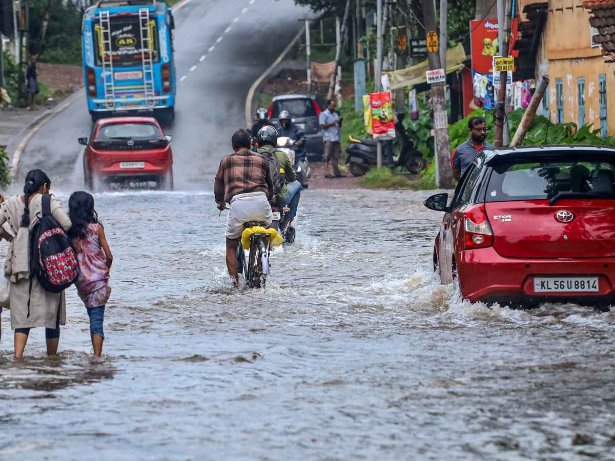
Monsoon has now covered the entire country including Delhi, the India Meteorological Department (IMD) on Sunday. IMD said the monsoon arrived nine days ahead of the usual July 8 timeline.
Monsoon was reported to have had spread across the remaining parts of Rajasthan, West Uttar Pradesh, Haryana, and the national capital as of July 29.
Delhi-NCR over the weekend witnessed light to moderate rainfall. Areas such as Rohini, Pitampura, Karawal Nagar, Rajouri Garden, Dwarka, and IGI Airport experienced showers and gusty winds.
Neighbouring stated like Haryana and western Uttar Pradesh, including Noida, witnessed scattered rain and thunderstorms.
In Uttarakhand, authorities have suspended the Char Dham Yatra for 24 hours. The directive came after a red alert for heavy rainfall was issued.
How IMD Assesses Onset of Monsoon
Each year, the IMD assesses onset of monsoon onset after May 10. The assesment is based on a combination of meteorological factors including rainfall, wind, OLR and other factors.
1. Rainfall: At least 60% of 14 IMD designated southern weather stations must report rainfall of 2.5 mm or more for two consecutive days. These stations include Minicoy, Thiruvananthapuram, Kochi, Mangalore and others.
2. Wind Field: Westerly winds must reach up to 600 hectoPascals (hPa) in depth. The wind speeds need to range between 15-20 knots (27–37 km/h) at the 925 hPa level.
3. Outgoing Longwave Radiation (OLR): Satellite-derived OLR values must be below 200 watts per square metre. OLR is the radiation emitted from the Earth’s upper atmosphere playing a crucial role in monsoon activity. It influences the lower atmosphere and surface temperature.
If all the above conditions are met, IMD declares the monsoon onset over Kerala on the second observation day.
This year, the monsoon began with a simultaneous onset over Lakshadweep, Mahe (Puducherry), large parts of the Arabian Sea and Bay of Bengal, and extended into southern Karnataka and Mizoram.
What Caused the Early Monsoon?
According to IMD, several large-scale ocean-atmospheric patterns and local factors contributed to the early arrival of the monsoon this year. It reached the south Andaman Sea and nearby areas by May 13, ahead of the normal date of May 21.
The department cited “very favourable conditions,” including the following:
1. Madden-Julian Oscillation (MJO): MJO is a moving disturbance of clouds, winds, and pressure originating in the Indian Ocean. Its phases can enhance rainfall activity in the country during the monsoon season.
2. Mascarene High: It is a high-pressure area located near the Mascarene Islands in the southern Indian Ocean. When the intensity of Mascarene High fluctuates, it brings heavy rain along India’s west coast.
3. Convection: It is the increase in vertical transport of heat and moisture. A convective system over Haryana moved southeast last week, causing rainfall in Delhi.
4. Somali Jet: It is a low-level cross-equatorial wind band originating near Mauritius and Madagascar. Somali Jet strengthens monsoon winds upon reaching the Arabian Sea and India’s west coast.
5. Heat-Low: Low-pressure zones forming over Pakistan and adjoining areas make Heat-low. It draws in moist air along the monsoon trough and aiding in rainfall development.
6. Monsoon Trough: It is an elongated low-pressure region stretching from the heat-low to the north Bay of Bengal. Its north-south movement is responsible for rainfall across the core monsoon region from June to September.
Also Read: Monsoon Disaster Update: 34 Killed In Himachal, Seven Missing In Uttarakhand, Char Dham Yatra Halted
Zubair Amin is a Senior Journalist at NewsX with over seven years of experience in reporting and editorial work. He has written for leading national and international publications, including Foreign Policy Magazine, Al Jazeera, The Economic Times, The Indian Express, The Wire, Article 14, Mongabay, News9, among others. His primary focus is on international affairs, with a strong interest in US politics and policy. He also writes on West Asia, Indian polity, and constitutional issues. Zubair tweets at zubaiyr.amin


